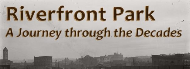
Riverfront Park has served as a meeting location, event space, and downtown destination since its inception in the 1970s. Now, over 40 years after its creation following Expo ‘74, an extensive revitalization and rehabilitation effort is underway by the City of Spokane’s Parks and Recreation Department to bring new life to this local landmark. The 100 acre area covered by the park has a long and varied history; from its beginnings as open and rocky land traditionally utilized by the Native American tribes of the region; to a bustling railroad hub in the 1920s; and now as an open green escape from the surrounding city. Evidence of this diverse past may still lie beneath the grassy expanses of Riverfront Park, possibly in areas where construction and improvements are set to take place. Members of the Fort Walla Walla Museum’s Heritage Research Services Spokane Tribe of Indian’s Preservation Program The report generated from this intensive work is a tool that can now be used to help identify and understand pieces of the past that may resurface during the revitalization process and was the basis for the information included in this website.
The area along the Spokane River, now known as Riverfront Park, was historically used by indigenous peoples long before the arrival of Euro-American settlers. The falls and rocky islands of the river channel are a valued part of the traditional grounds of the Spokane and Plateau tribes and provided a welcome relief from the open expanse of Eastern Washington. The Spokane River served as both a place to gather and as a source of nourishment for the people of the inland northwest for centuries prior to the time of westward expansion.
The first pioneers journeyed west following the path of fur traders and early explorers, arriving in the region in the 1860s. Some of the earliest settlers of eastern Washington began their new lives on the rocky landscape along the banks of the Spokane River as well as on the barren islands in the middle of the rapidly flowing waters. The arrival of the 1880s revealed a growing population centered around the timber and mining resources of the region, leading to the incorporation of the town of Spokan Falls in 1881 (the “e” was added in late 1883 creating the “Spokane” spelling we know today). Originally divided into 29 city blocks, the newly created town stretched south from the river to modern day Sprague Avenue and contained residential, commercial, and industrial buildings. The area that would eventually become Riverfront Park occupied at least six of these original blocks and faced Front Avenue (later renamed Trent Avenue and today, known as Spokane Falls Boulevard). The large island in the middle of the river, originally known as Big Island and renamed Havermale Island in 1889, was not included in the town of Spokane Falls but development continued on this rough land nonetheless.
The area continued to grow throughout the 1880s, becoming a bustling commercial and residential neighborhood complete with hotels, shops, a red-light district and Chinatown. Factories and expanding mill production provided opportunities and jobs for the residents who lived in the nearby blocks. Employment and affordable living quarters attracted many of the region’s immigrants, creating a diverse and concentrated cultural population in an area encompassing only a few blocks.
In 1889, the young town of Spokane Falls was ravaged by a destructive fire, drastically changing the landscape of the growing city. Damage spread across downtown, leveling multiple blocks and disrupting everyday function of the city. The majority of the structures on Havermale Island were undamaged, allowing life and work on the island to continue with little interruption. With the help of money from foreign Dutch investors, downtown Spokane and more specifically, the area around the Spokane River, was able to fully recover and reached its peak of production and activity by the year 1910. Home to over one thousand residents, forty businesses, two passenger depots, and Spokane’s City Hall, jail, and fire department, the area near the banks of the Spokane River was a thriving center of life and industry.
The construction of the Union Pacific Passenger Depot and elevated track in 1914 drastically changed the landscape and displaced many of the residents in the hotels and lodgings in the area. Combined with the pre-existing Great Northern Depot, the heart of downtown Spokane now became the very center of the railroad industry and passenger transport for the region. The landscape was densely filled with tracks and railroad buildings as well as the frequently passing trains, creating a busy and noisy city center. During the 1920s and the following four decades, the Riverfront Park area functioned almost exclusively as a commercial district and Spokane’s transportation hub with few major changes.
From the 1950s to the late 1960s, the industrial and residential life of the area had declined significantly from its previous glory, resulting in the demolition of many of the buildings that had stood for decades to make room for new construction including multiple parking lots. By 1950, residential units on Havermale Island had shrunk to one remaining apartment building – the Griffin, and only 18 residents were listed in the city directory. The biggest change to the area in the 20th century took place with the arrival of Expo ’74. Most structures on the island including the lumber mill, railroad depots, and many other commercial and industrial buildings, were demolished and the land cleared to facilitate the building of the infrastructure needed for the World’s Fair.
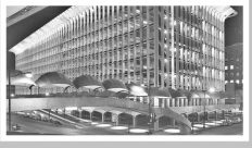
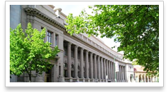
Many of the buildings that were razed for the creation of the exposition had long influenced the industrial landscape of Spokane. Riverfront Park was created at the conclusion of Expo ’74, emerging as a community space in the heart of the quickly modernizing city. The land that had previously been covered by railroad tracks, lumber yards and factories now housed a green oasis punctuated by art, city views and the flowing Spokane River. Very little original architecture remains from the past life of the park. The preservation of features from the World’s Fair such as the U.S. Pavilion and Theme Stream, contrast and coexist with the grand Great Northern Clock Tower that continues to stand as a reminder of the industry, people and land that helped to build Spokane into the town it is today.
Journey through the history of life along the Spokane River and the development of the city. Click on any of the decades below to get started!
Interactive Map
Use the map tool to investigate the buildings in the area that is now Riverfront Park. The long and diverse history created an environment where multiple buildings or businesses occupied the same location at different times (zoom in close to be able to click on each pin). Use the legend at the bottom of the map to visualize the changes over the course of many decades and see the diverse history of early Spokane.
Click on a pin to see the history of the buildings and business at each location through the years!
Historic Resources
Additional archival sources such as photographs, manuscripts, land records, and property records were utilized including the Northwest Archives and Eells Northwest Collection at Whitman College , the Washington State University Digital Libraries Collection Northwest Museum of Arts and Culture Digital Collection .
Click on any of the images below to explore further!
Building Information on Sanborn Maps
1891-1950
Census Information
1900-1940
City Directories
1891-1960
Household Heads and Businesses
1902 & 1910
Acknowledgements For the Survey Report “An Assessment of Archaeological Potential for Proposed Upgrades to Riverfront Park, Spokane, Washington” : Ashley Morton (Archaeologist, FWWM), author; James Harrison , (Archaeologist, STIPP), contributor. Support for the document’s preparation included contributions by Lauren Benz (GIS Analyst, Benz GIS Services LLC.), Kimberly Sutherland (Research Assistant, FWWM), and Madeline Duppenthaler (Volunteer, Whitman College student). The following people provided input and guidance for the work: Karen Swope (Archaeologist, Statistical Research Inc.,) Bill Matt (Spokane Tribe of Indians, Tribal Ranger), John Matt (STIPP Program Manager), Randy Abrahamson (Spokane Tribal Historic Preservation Officer), Guy Weaver (Archaeologist, Weaver and Associates LLC.), and Megan Duvall (City/County Historic Preservation Officer).
For the website:
Photo credits this page: Banner: NW MAC, JEF Research Archives, Charles Libby (photographer) L84-327.923Timeline Images
